
The Shringi Himal climb is one of the exciting opportunities. In the context of the Nepalese trekking fraternity, Shringi Himal Climb is known by a different name.
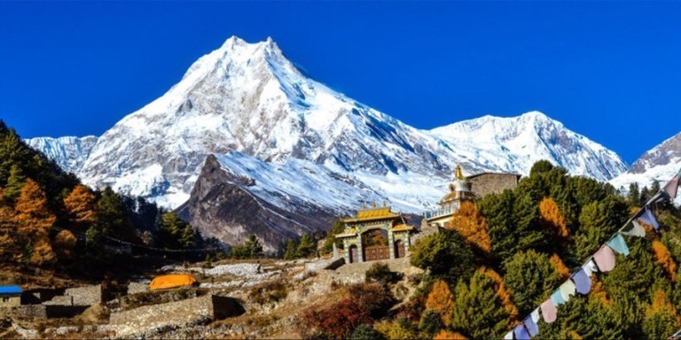
In some places, it is called the Chamar peak while in other places, you could find it with the name of Serang Himal. All in all, Shringi Himal is located in the central part of Nepal, which is south of the Tibetan border.
As the peak is new to its name, there aren’t a lot of climbing attempts that have been made to Shringi Himal. Today, through this article, we will learn about the complexities, issues, and features of the Shringi Himal Climb.
Shringi Himal Climb Overview
Located in the Tibetan border between the Shayar Khola on the east and the Tom Khola on the west, Shringi Himal is one of the rare gems to climb.
This particular peak is located in the northwest of the Kathmandu valley. Majorly known to be closer to Manaslu mountain, Shringi Himal has different names in different places.
Shringi Himal stands at an altitude of 7187m. Anyone willing to climb Shringi must reach the Gorkha region. It is known as the subrange peak, which is in the Gandaki province.
Present at an altitude above 7000m, trekkers must be experienced to perform this trek. With The Trek Nepal, our experienced team will help you to reach the top of Shringi Himal.
Highlights of Shringi Himal Climb
- Outstanding views of peaks like Manaslu, Ganesh Himal, Annapurna, Machhapuchhre
- Less-travelled trek with remote features
- Understanding the culture and traditions of Buddhist people in the Tsum Valley
- Utilisation of skills in mountain climbing, use of crampons, etc
Who Climbed Chamar Peak For The First Time?
There are a lot of queries about who made the Shringi Himal climb a success first. Well, the answer goes back to 1953. Even though the peak is famous in recent times, the first ascent was made in the late 50’s.
A team from New Zealand was able to achieve this feat. Tararua tramping club was able to climb Shringi Himal on 5th June, 1953.
Since then, the doors have been opened for the common people. Along with the Kiwi groups, the climbers Maurice Bishop and Namgyal Sherpa were also able to get to the top.
Interestingly on the very next day, the team of Phil Gardner, Graham McCallum, and Sherpa Nima was able to get to the top. This climb took place on 6th June.
The group of 3 were able to climb to the top through the Northeast ridge route. They didn’t use the supplementary oxygen, and the climb was a success.
Best Time to Perform the Shringi Himal Climb
The best time to perform the Shringi Himal climb is during the months of spring and autumn. During this period, the air remains swift, and the temperature for longer treks becomes much easier.
Autumn falls during the months of September to November, while spring is more about March to May. Mainly during autumn, there are festivals too, which makes the overall trekking mood more vibrant.
One of the key reasons to perform the Shringi Himal climb is to get brilliant views of the mountains. With the perfect weather and climate, the mountains are highly visible. Not only that, but you also get easier trekking routes.
Some of the readers might question whether a monsoon and winter trek is possible. Well, that is possible too. However, you will need to be mentally prepared for it.
The crowd on the trail might be smaller; however, you must be prepared for unforeseen circumstances. Major temperature drop with uneven weather conditions makes trekking in the Shringi Himal during winter and monsoon very hard.
How Difficult Is the Shringi Himal Climb?
Not due to the lack of popularity of the trek, but the Shringi Himal Climb is actually a tough trek to complete. Trekkers need to be physically fit and mentally strong.
It is termed to be a technically challenging climb, which is better suited for experienced and seasoned climbers. As the altitude soars beyond 7000m, you must know about the trek.
However, with The Trek Nepal, we teach every step and the whole process to our clients. With the use of technical gear like ice axes, crampons, ropes, and solid mountaineering skills, you will be able to complete the trek.
Anyone interested in this trek must have physical fitness and mental strength. Trekking for more than 7 hours over a period of 2 weeks can be challenging. Therefore, perform some smaller treks before jumping into this one.
Climbing Route and Accessibility
As the trekking opportunity and the location suggest, Shringi Himal Climb is primarily located in the Annapurna region. It is closer to the Tibetan border in the Mustang district.
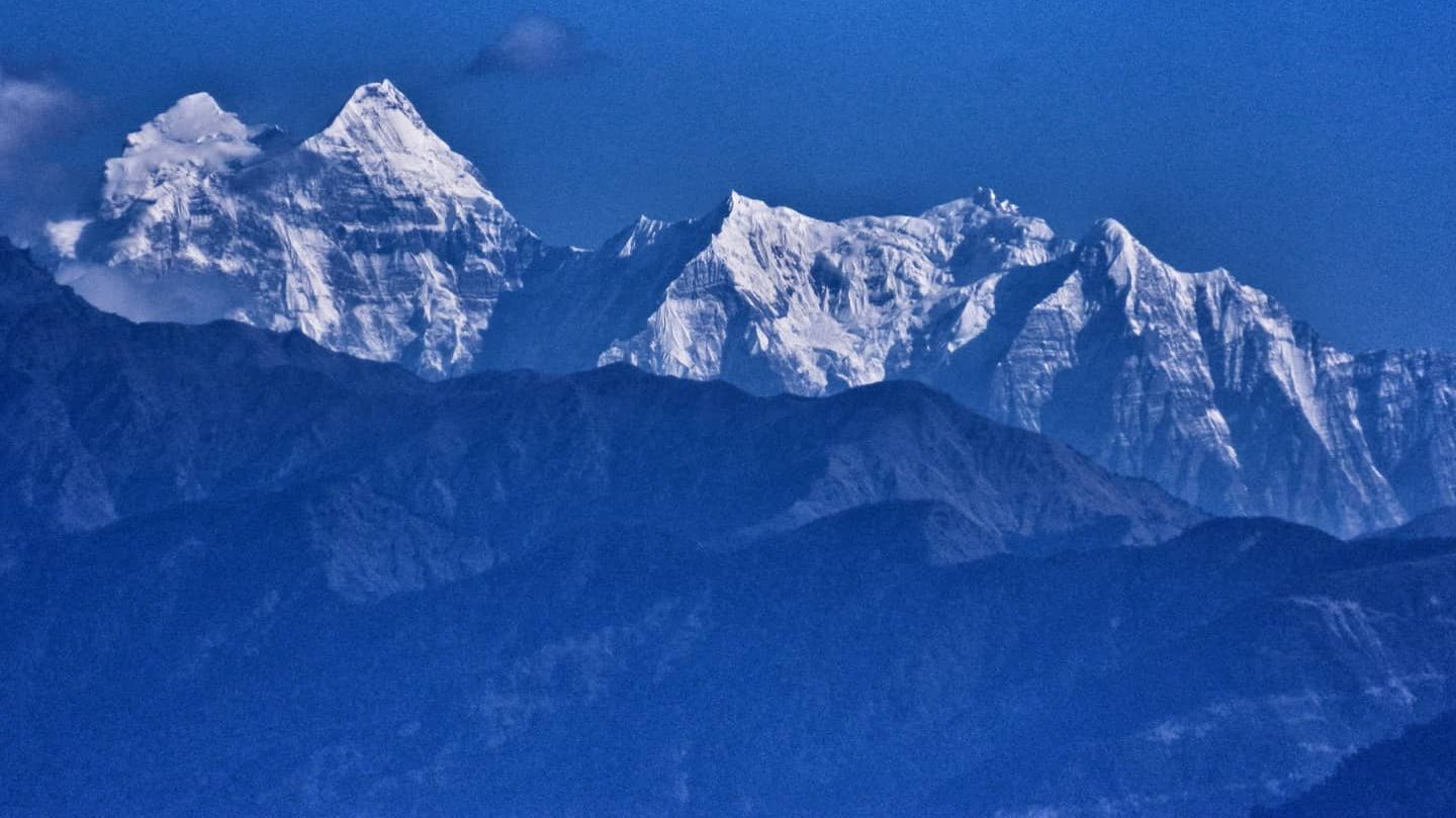
An interested individual can perform this trek through the ABC and also right beyond the Jomsom region. The trek involves mixed feelings of scenic views, rhododendron forest, and also the alpine meadows.
Starting from Pokhara, the journey moves ahead to Jomsom, Kagbeni, and into the Annapurna region. Although the route to Base Camp looks easier, the real challenges begin after that.
The base camp for the Shringi Himal climb is at 5300m. From this point in time, The Trek Nepal prepares everyone with the right training and pushes them to the summit.
Through the trekking journey, you will experience a mix of snow and ice climbing. There are also traces of technical rock climbing, with certain sections being physically hard.
Crevasses, snowfield, and steep ridgelines, this climb might not be the hardest 7000m climb, but it will test your mental strength, skill, and determination.
Permits Needed For Shringi Himal Climb
Present in the remote region of Nepal, you must have all the permits ready to complete this trek. All of the permits will be available at the Nepal Tourism Board, or you can connect with your agent, too.
The Trek Nepal manages all the permits if you are interested in the trek. For solo trekkers, though, permits needed for the Shringi Himal climb are:
- Manaslu Restricted Area Permit
- Manaslu Conservation Area Permit
- Annapurna Conservation Area Permit
- Trekkers Information Management System (TIMS) card
Detailed Itinerary For Shringi Himal Climb
Day 1: Arrival in Kathmandu (1,400m)
Arrive in Kathmandu and transfer to your hotel. This day is for rest and preparation after travel. In the evening, you meet your expedition team, review the Shringi Himal climb plan, and conduct a gear check. Final permits and logistics are confirmed for this remote journey.
Day 2: Fly to Nepalgunj (150m)
Take a short domestic flight from Kathmandu to Nepalgunj, a lowland city near the Indian border. The climate change is noticeable as you enter the Terai region. This stop helps stage the expedition before heading into Dolpa. Final packing and cargo preparation for the Shringi Himal climb are done here.
Day 3: Fly to Juphal & Trek to Dunai (2,850m)
An early scenic flight takes you to Juphal Airport. From here, the trek begins descending toward the Thuli Bheri River valley. Passing terraced fields and local settlements, you reach Dunai, the administrative center of Dolpa. This marks the start of the remote trekking phase.
Day 4: Trek Dunai to Tarakot (2,540m)
The trail follows the Bheri River through deep valleys and traditional villages. You pass police checkpoints and old trade routes before reaching Tarakot, an ancient fortress village with historical significance. The day is relatively gentle to help initial acclimatization during the Shringi Himal climb.
Day 5: Trek Tarakot to Laini (3,160m)
Moving deeper into wilderness, the trail narrows along steep cliffs above the river. Suspension bridges and rugged terrain define the day. You gradually gain elevation before arriving at Laini, a small riverside campsite. The landscape becomes more alpine and less populated.
Day 6: Trek Laini to Nawarpani (3,545m)
The trail climbs steadily with dramatic canyon views. Sections of landslide-prone paths require caution. As you gain altitude, vegetation thins and the environment feels increasingly remote. Camp is set at Nawarpani, a quiet resting point used by trekkers and herders.
Day 7: Trek Nawarpani to Dho Tarap (4,040m)
Today opens into a wide high-altitude valley as you reach Dho Tarap. This beautiful settlement is rich in Tibetan culture, with monasteries and chortens dotting the landscape. It is one of the highest permanent settlements in Nepal and an important acclimatization point for the Shringi Himal climb.
Day 8: Acclimatization Day at Dho Tarap (4,500m hike)
A rest day with a short acclimatization hike to nearby ridges above Dho Tarap. You explore monasteries and interact with locals while allowing your body to adjust to altitude. This day is crucial before heading toward more technical terrain.
Day 9: Trek Dho Tarap to Tokyu Gaon (4,200m)
The trail ascends gently through open landscapes with views of surrounding peaks. You reach Tokyu Gaon, a traditional highland village. The terrain becomes more rugged, and the route toward Shringi Himal starts to diverge from common trekking paths.
Day 10: Trek to Base Camp of Shringi Himal (Approx. 4,800m)
Leaving established trails, you move toward the remote base of Shringi Himal. The route crosses alpine meadows and glacial streams with increasing views of the mountain. Base Camp is established in a sheltered valley beneath the peak, marking the start of the climbing phase of the Shringi Himal climb.
Day 11–13: Acclimatization & Climbing Preparation (Up to 5,500m)
These days are used for acclimatization rotations. You practice rope work, glacier travel, and establish higher camps if needed. Climbers explore the route, fix lines, and prepare for the summit push. This staged approach improves success and safety.
Day 14: Summit Push – Shringi Himal (Approx. 6,187m)
The summit attempt begins early, navigating snow slopes and possible mixed terrain. Weather and conditions determine the exact route. Reaching the summit of Shringi Himal offers panoramic views of the remote Kanjiroba region. After the summit, descend back to Base Camp.
Day 15: Contingency Day
Reserved for bad weather or additional summit attempts during the Shringi Himal climb. This flexibility is essential in such a remote expedition.
Day 16–20: Return Trek to Juphal (2,475m)
Retrace your route back through Tokyu, Dho Tarap, Nawarpani, Laini, Tarakot, and Dunai. The descent is faster but still physically demanding. The familiar landscapes now feel different after the summit success of the Shringi Himal climb.
Day 21: Fly Juphal to Nepalgunj & Kathmandu
Fly from Juphal to Nepalgunj and connect onward to Kathmandu. The return marks the end of the expedition phase.
Day 22: Final Departure to home nation
After the early morning breakfast on the 22nd day, we officially end the overall trek. A member from The Trek Nepal will drop you off at the airport, and we bid you goodbye.